
Parinacota
Location: 18° 9’ 58’’ S, 69° 8’ 33’’ W
Elevation: 6348 m
Pomerape
Location: 18° 7’ 33’’S. 69° 7’ 39’’ W
Elevation: 6222 m
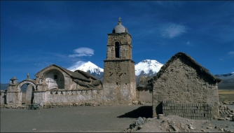
 BOLIVIA 1994
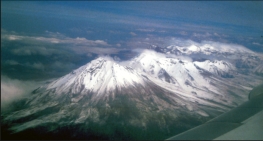
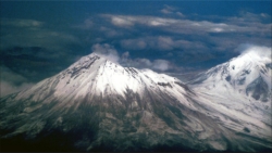
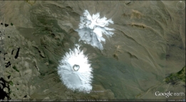
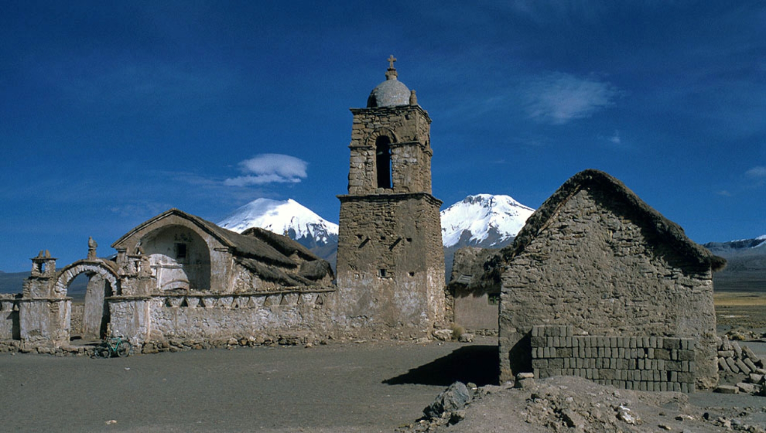
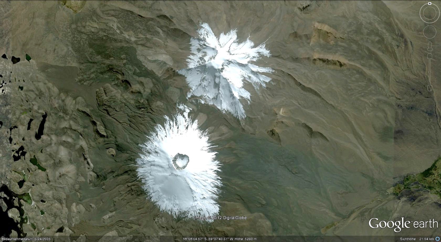
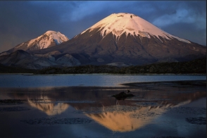 Volcán Parinacota is the southernmost and youngest of a pair of volcanoes forming the Nevados de Payachata
volcanic group along the Chile-Bolivia border. The symmetrical, 6348-m-high Parinacota volcano forms a twin
volcano with the dominantly Pleistocene, 6222-m-high Pomerape volcano, which towers above a low saddle to the
NE. Collapse of Parinacota about 8000 years ago produced a 6 cu km debris avalanche that traveled 22 km to the
west and blocked drainages, forming Lake Chungará. Holocene eruptive activity has subsequently reconstructed
the Parinacota stratovolcano, which contains a pristine, 300-m-wide summit crater and youthful lava flows on the
western flanks. Although no historical eruptions are known from Parinacota, Helium surface-exposure dates have
been obtained for eruptions during the past two thousand years both from the main cone and the Ajata group of
satellite cones and lava flows on the south and SW flanks (Global volcanism Program).
HOME
click on pictures
Photos: Rolf Cosar 15.02.1994
Volcán Parinacota is the southernmost and youngest of a pair of volcanoes forming the Nevados de Payachata
volcanic group along the Chile-Bolivia border. The symmetrical, 6348-m-high Parinacota volcano forms a twin
volcano with the dominantly Pleistocene, 6222-m-high Pomerape volcano, which towers above a low saddle to the
NE. Collapse of Parinacota about 8000 years ago produced a 6 cu km debris avalanche that traveled 22 km to the
west and blocked drainages, forming Lake Chungará. Holocene eruptive activity has subsequently reconstructed
the Parinacota stratovolcano, which contains a pristine, 300-m-wide summit crater and youthful lava flows on the
western flanks. Although no historical eruptions are known from Parinacota, Helium surface-exposure dates have
been obtained for eruptions during the past two thousand years both from the main cone and the Ajata group of
satellite cones and lava flows on the south and SW flanks (Global volcanism Program).
HOME
click on pictures
Photos: Rolf Cosar 15.02.1994
BOLIVIA 1994


 Volcán Parinacota is the southernmost and youngest of a pair of volcanoes forming the Nevados de Payachata
volcanic group along the Chile-Bolivia border. The symmetrical, 6348-m-high Parinacota volcano forms a twin
volcano with the dominantly Pleistocene, 6222-m-high Pomerape volcano, which towers above a low saddle to the
NE. Collapse of Parinacota about 8000 years ago produced a 6 cu km debris avalanche that traveled 22 km to the
west and blocked drainages, forming Lake Chungará. Holocene eruptive activity has subsequently reconstructed
the Parinacota stratovolcano, which contains a pristine, 300-m-wide summit crater and youthful lava flows on the
western flanks. Although no historical eruptions are known from Parinacota, Helium surface-exposure dates have
been obtained for eruptions during the past two thousand years both from the main cone and the Ajata group of
satellite cones and lava flows on the south and SW flanks (Global volcanism Program).
HOME
click on pictures
Photos: Rolf Cosar 15.02.1994
Volcán Parinacota is the southernmost and youngest of a pair of volcanoes forming the Nevados de Payachata
volcanic group along the Chile-Bolivia border. The symmetrical, 6348-m-high Parinacota volcano forms a twin
volcano with the dominantly Pleistocene, 6222-m-high Pomerape volcano, which towers above a low saddle to the
NE. Collapse of Parinacota about 8000 years ago produced a 6 cu km debris avalanche that traveled 22 km to the
west and blocked drainages, forming Lake Chungará. Holocene eruptive activity has subsequently reconstructed
the Parinacota stratovolcano, which contains a pristine, 300-m-wide summit crater and youthful lava flows on the
western flanks. Although no historical eruptions are known from Parinacota, Helium surface-exposure dates have
been obtained for eruptions during the past two thousand years both from the main cone and the Ajata group of
satellite cones and lava flows on the south and SW flanks (Global volcanism Program).
HOME
click on pictures
Photos: Rolf Cosar 15.02.1994